Advanced geospatial technology from higher ed comes to Chicago Public Schools
A program based at James Madison University (JMU) that teaches high school students about geospatial thinking and technology in exchange for college credit is expanding to Chicago Public Schools.
About 3,500 students from 23 Virginia schools have participated in the Geospatial Semester at JMU, a research university located in Harrisonburg, Virginia, since the program started in 2005.
Bob Kolvoord, dean and professor of the College of Integrated Science and Engineering at JMU, said the Geospatial Semester was created to steer students away from high-stakes testing and expose them to more problem-based learning through projects that require collaboration.
“We looked to see if we could design an experience that could connect them with some content and technology that they hadn’t seen before,” Kolvoord said in an interview with EdScoop. “It allowed them to take ownership of the problem, to see how technologies could play a role.”
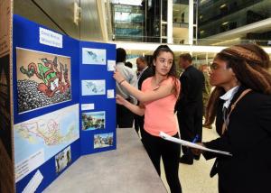
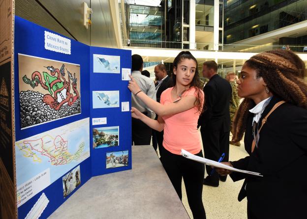
Students are trained to use Geographic Information System (GIS) technology — computerized mapping tools, essentially — to solve a local problem in their communities. Students have proposed projects on traffic management, alternative energy and food deserts.
The classes are taught on-site at the participating public and private schools, with JMU professors acting as mentors to train classroom teachers and provide technical support.
The National Science Foundation awarded $2 million in grants to JMU, Northwestern University and Chicago Public Schools — one of the largest school districts in the country — to adapt the GIS program, which will launch this summer.
Students in Chicago will become familiar with GIS software, remote sensing data and GPS technology, and obtain credit from the City Colleges of Chicago.
Students in Virginia are also starting to complete projects on their mobile devices, using apps and location-based technologies like Survey123 and Collector. Most of the applications and software are provided by ESRI , “the Microsoft of the GIS world,” according to Kolvoord. The California-based company makes all of its technology available for free to K-12 schools.
Kolvoord said he and his team wanted to explore opportunities to scale the program to other cities.
“We saw a real opportunity and [Chicago Public Schools officials] were interested in working with us,” he said. “We will start the first teacher workshops in two weeks, with the idea that we’re going to help them get started, but help them stand on their own.”
Chicago teenagers will likely have a different set of local issues to solve than kids in rural Virginia — for one project, a group created digital maps with the goal to resettle bears, a nuisance where they live near the Shenandoah Valley.
“They figured out the range of bears and how to keep them far enough away so they could have their own territory,” said Kolvoord.
The students eventually shared the information with the U.S. National Park Service.
Along with preparing students for potential STEM careers, JMU is also conducting an extensive research effort to detect neural and behavioral changes in the students who are developing spatial thinking over the yearlong course.
“We bring them to Georgetown University and get hooked up to FMRI scanners, which shows areas of your brain that are activated when you’re doing certain tasks,” said Kolvoord. “We’re seeing evidence that suggests the use of this technology and working on these problems actually does promote different kinds of brain development.”
He added that this program is essential because schools don’t typically teach students geography outside of learning the names of state capitals and oceans.
“The K-12 curriculum is pretty rigid, and it doesn’t open up a lot of access to disciplines like geography or sociology or anthropology,” he said. “[The Geospatial Semester] has really driven their interest, and many of them actually come to JMU and end up majoring in geographic science.”
As GIS technology evolves, Kolvoord said expanding the program to other places might not be such a farfetched idea.
“It used to be that you had to install a fairly complicated desktop package, but more and more, it’s going to cloud-based and online,” he said. “So the barrier to entry is coming way down. It’s going to enable us to do things we couldn’t imagine five years ago.”
Reach then reporter at corinne.lestch@edscoop.com and follow her on Twitter @clestch and @edscoop_news .