U. Illinois partners with state to produce COVID-19 maps, tools
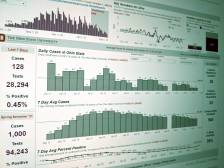
The Univeristy of Illinois’ geospatial studies center has partnered with the Illinois state government to create “a system of interactive maps, charts and animations” that will better track the spread of COVID-19.
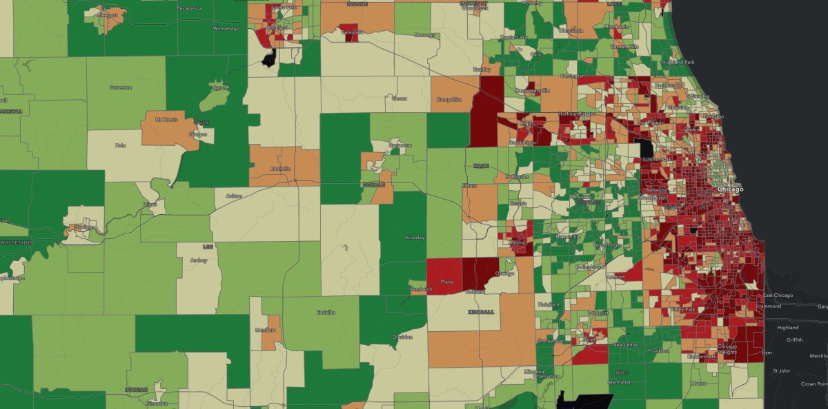
The project, called WhereCOVID-19, is housed in the university’s CyberGIS Center for Advanced Digital and Spatial Studies and will visualize the state’s current cases, as well as help state leaders answer where undiagnosed cases will likely arise.
“WhereCOVID-19 supports rapid measurement of spatial accessibility to healthcare resources, which provides an improved understanding of how well healthcare infrastructure is equipped to save people’s lives during the COVID-19 pandemic,” said Shaowen Wang, the director of the CyberGIS Center. “Spatial accessibility knowledge enables policymakers and public health practitioners to allocate existing healthcare resources or distribute new resources for maximum access to health services.”
The project relies on data from several sources, including case counts from the Illinois Department of Public Health. In addition to predicting where the virus could spread, the tool also maps where vulnerable populations live, where containment measures would be effective, where health care systems might be overwhelmed by increasing cases and where more testing and resources should be deployed.
Though built on geospatial information systems technology, Wang said the tool is designed to be easy to use, even by those with no GIS background.
Though initially released as an online dashboard, the platform will also get mobile app, according to the university.
“We have rapidly established the online WhereCOVID-19 platform designed to provide spatial decision support based on exploration and discovery of spatiotemporal patterns of the pandemic and its impacts,” Wang said.